You may see RTK GNSS listed on a robotic mower, drone, survey receiver, or mapping tool and assume the acronym alone guarantees precise positioning. In practice, performance also depends on sky visibility, correction availability, signal reflections, and how well the equipment converts coordinates into movement.
This article explains what RTK GNSS means, how real-time corrections work, and why accuracy changes between open and obstructed sites. You will also learn what equipment is required, how correction sources differ, and when RTK is a practical choice for repeatable navigation around lawns, boundaries, structures, and work areas.
What Does RTK GNSS Mean?
RTK GNSS stands for Real-Time Kinematic Global Navigation Satellite System. GNSS is the broader satellite-positioning framework that includes constellations such as GPS, Galileo, GLONASS, and BeiDou. A receiver estimates its location by measuring signals from several satellites.
RTK is the precision layer added to that process. A base station or correction network compares satellite measurements with a known reference position, then sends error corrections to a moving receiver, called the rover. The rover applies those corrections continuously while it works.
RTK is therefore a positioning method built on GNSS measurements, not a separate satellite constellation. Its value is repeatability: the system can return to the same mapped line or boundary with far less drift than ordinary standalone positioning. This supports surveying, machine guidance, drone mapping, precision landscaping, and robotic mowing. Reliable results depend on sufficient sky visibility, usable correction data, and stable communication between the correction source and the rover.
How Accurate Is RTK GNSS?
Centimeter-level positioning is possible when the complete signal chain remains stable. The following conditions determine how accurately an RTK receiver can hold and repeat its position while moving.
- Satellite visibility: Open sky supports stronger satellite geometry and continuous tracking. Trees, roofs, walls, and metal structures can block or reflect signals, so inspect the entire working route rather than one open test point.
- Correction availability: The receiver needs current data from a base station or network. Radio range, cellular coverage, internet stability, and service availability all influence how consistently the highest-precision solution can be maintained.
- Reference distance: A rover generally performs best when correction data represents conditions close to its location. Network RTK uses several reference stations to model errors across a wider service area.
- Performance in motion: Accuracy should remain consistent through turns, slopes, narrow passages, and areas beside structures. Check repeated path alignment and boundary consistency instead of relying only on a headline specification.
What Equipment Does an RTK GNSS System Need?
A precise coordinate is useful only when every component can receive, correct, transmit, and apply the data consistently. An RTK setup therefore combines positioning hardware, connectivity, and control software.
- Rover receiver and antenna: The moving unit measures signals from multiple satellites. Antenna placement needs a broad sky view and a stable mounting position so movement or vibration does not introduce avoidable variation.
- Correction source: A local base station, RTK network, or integrated service supplies reference data from known coordinates. Compatibility with the receiver and coverage across the working area are essential.
- Communication link: Corrections reach the rover through radio, cellular data, internet, or a product-specific connection. The link must stay available across the full route, including areas beside buildings or at property edges.
- Control software: The application or machine controller converts corrected coordinates into mapped points, steering commands, boundaries, or repeatable paths. Good positioning data has limited value unless the system can act on it smoothly.
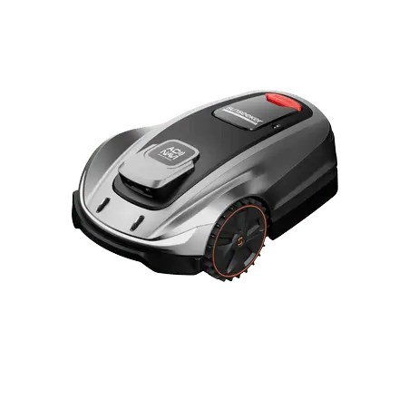
Large lawns with virtual boundaries and planned routes benefit from a system that combines these elements in one workflow. The Sunseeker Elite X9 uses AONavi 2.0 with network RTK and VSLAM 2.0, while 360-degree OmniSight supports navigation around real yard features. These technologies work together to turn corrected positions into consistent mowing paths rather than treating RTK as a stand-alone specification.
How Does RTK GNSS Work?
Once the equipment is connected, RTK improves position through continuous comparison between satellite observations at a known reference point and measurements collected by the moving receiver.
Satellites broadcast timing and orbital information. A standalone GNSS receiver uses those signals to estimate position, but its result includes small errors from satellite clocks, orbital data, the atmosphere, and local reflections.
A base station occupies a known coordinate, or a network models corrections from several known stations. Because the reference position is established, the system can calculate the difference between the measured satellite result and the expected result, then send corrections to the rover in real time.
The rover combines those corrections with precise carrier-phase measurements and continually updates its coordinate as it moves. When the system resolves the carrier-phase ambiguities and maintains a stable correction link, it can produce a fixed, repeatable position at centimeter scale. If signal conditions change, the receiver keeps evaluating solution quality and re-establishes the precise fix as usable measurements return.
Which RTK Correction Options Are Available?
Once the receiver is selected, the correction source determines how reliably it can maintain a precise fix. Compare coverage, installation effort, connectivity, compatibility, and recurring cost before choosing.
- Local base station: A fixed receiver at a surveyed or accurately established point sends corrections to nearby rovers. It gives the site owner direct control, but the antenna needs clear sky, secure mounting, and reliable radio or data coverage.
- Network RTK: A service combines data from multiple reference stations and sends corrections through the internet, often using NTRIP. It can cover a wider area without a private base, provided the receiver is compatible and cellular connectivity remains stable.
- Integrated product service: Some consumer systems bundle the receiver, correction access, mapping, and communication path. This reduces setup work because the user manages virtual boundaries and operating zones through one application rather than survey-style equipment.
- Connection method: Radio can suit a controlled local site, while cellular or internet delivery supports network services. Check signal strength at the farthest boundary, beside structures, and through narrow passages before finalizing the setup.
Why Is RTK GNSS More Accurate Than Standard GNSS?
The accuracy gain comes from differential correction and precise carrier-phase measurements, not simply from receiving more satellites. RTK compares two nearby sets of observations to remove shared errors.
Standard GNSS commonly relies on code-based distance measurements that are suitable for navigation, fitness tracking, and general location awareness. Small timing, atmospheric, and orbital errors remain in the standalone estimate, so the reported position can drift by several feet.
RTK adds measurements from a known reference point and sends corrections to the rover in real time. Errors affecting both receivers in a similar way can be reduced, while carrier-phase processing provides a much finer measurement than code alone. After the receiver resolves the carrier ambiguity, it can maintain a fixed solution with centimeter-level repeatability under suitable conditions.
This matters whenever the system must follow the same edge, line, or route repeatedly. The practical benefit is not merely a more precise coordinate on a screen; it is more consistent guidance while the machine is moving.
When Should You Use RTK GNSS?
RTK is most valuable when a small position error changes the outcome and the route must be repeated consistently. Evaluate both the task and the signal environment before selecting it.
- Boundary-free mowing: A robot lawn mower can use RTK to maintain virtual working zones, follow planned routes, and return to mapped edges without a buried perimeter wire. Open sky and continuous correction coverage support the most consistent result.
- Surveying and layout: RTK suits property points, construction layout, grading checks, and landscape features where coordinates must be revisited accurately. Confirm the required horizontal and vertical tolerance before choosing the receiver and correction service.
- Machine guidance: Agricultural equipment, utility machines, and automated vehicles benefit when passes need to align closely and repeat across the same work area. Stable corrections reduce cumulative route drift.
- Drone mapping: RTK can improve image geotagging and flight-line consistency, reducing the amount of ground control needed for some projects. Flight planning still needs clear reception and compatible processing software.
- Site suitability: Walk the full operating area and check sky visibility near trees, walls, sheds, and narrow corridors. A hybrid system that combines RTK with vision or inertial sensing can maintain smoother navigation through mixed conditions.
Conclusion
RTK GNSS is a practical precision tool when repeatability matters, not simply a stronger version of GPS. Its performance comes from the complete chain: visible satellites, current correction data, a stable link, and software that can use the position in motion. Compare the correction method with the actual site, then test difficult areas near trees, walls, and narrow passages. When those conditions are managed well, RTK can support accurate boundaries, planned routes, and consistent machine guidance with far less drift than standard standalone GNSS.
FAQs
What Does GNSS Stand For?
GNSS stands for Global Navigation Satellite System. It is the umbrella term for satellite constellations that provide positioning, navigation, and timing, including GPS, Galileo, GLONASS, and BeiDou. A compatible receiver can use signals from several constellations at once, improving satellite availability and geometry. RTK then adds real-time corrections to those GNSS measurements for greater precision.
What Is the Difference Between GPS and RTK?
GPS is one satellite constellation used to estimate position. RTK is a correction technique applied to GPS or other GNSS measurements. It compares observations from a moving receiver with data from a known reference source, then reduces shared timing, orbital, and atmospheric errors. The result can provide centimeter-level repeatability, while standalone GPS generally supports broader meter-level navigation.
What Environmental Factors Reduce RTK Accuracy?
Dense tree canopies, tall walls, roofs, metal structures, and narrow courtyards can block or reflect satellite signals. Accuracy can also vary when cellular or radio corrections become unstable, the rover moves too far from a local base, or heavy rain and foliage weaken reception. Test the complete route and review solution quality near known obstructions before relying on mapped boundaries.













 X7 / X7 Plus Gen 2High-performance mowing for lawns up to 1.5 Acres.USD 2499 / USD 2999
 Learn More
 X5 Gen 2Powerful and versatile, for lawns up to 0.5 Acre.USD 1999
 Learn More
 X4Smart LiDAR mower built for effortless, boundary-free lawn care.USD 1399
 Learn More
 X7 / X7 Plus / X7 ProPower Through Every Slope.
 Learn More
 X5Smart Vision. Effortless Mowing
 Learn More