GNSS is the satellite-positioning framework, GLONASS is one GNSS constellation, and RTK is a precision correction technique that uses carrier-phase observations plus reference data. Under good satellite visibility and correction quality, RTK can achieve centimeter-level positioning, but multipath, correction outages, and long baselines can reduce reliability.
An RTK receiver can show a fixed centimeter-level solution in an open field and then lose that precision beside trees or a building. Understanding why requires separating three ideas that are often mixed together: GNSS is the satellite-navigation framework, GLONASS is one constellation, and RTK is a correction method. This guide explains how multi-constellation positioning and carrier-phase corrections work together, then focuses on the signal, correction-link, and baseline conditions that determine real accuracy.
What Do GNSS, GLONASS, and RTK Mean?
These terms are closely related but they describe different layers of a positioning system. Separating the system, constellation, and correction method makes the relationship much easier to understand.
GNSS as the Satellite Positioning Framework
GNSS is the umbrella term for satellite navigation systems that provide positioning and timing. A GNSS receiver estimates ranges to multiple satellites whose positions and clock information are broadcast in navigation messages. With enough observations, it solves for the receiver’s three-dimensional position and clock offset. Standalone consumer GNSS is typically accurate to a few meters in good open-sky conditions, while professional techniques such as RTK add corrections and carrier-phase processing to reach much finer accuracy. “GNSS” therefore describes the system family, not one specific constellation or precision level.
GLONASS as a GNSS Constellation
GLONASS is one member of the GNSS family. A receiver labeled “GNSS” may support GLONASS together with GPS, Galileo, BeiDou, or other signals. Adding GLONASS can increase the number of visible satellites and improve geometry when part of the sky is blocked. It is not a correction service and does not by itself imply centimeter accuracy. The final result still depends on antenna quality, multipath, satellite geometry, atmospheric conditions, and the positioning algorithm. RTK-capable equipment can use GLONASS carrier-phase observations when the receiver and correction source support them.
RTK as a Correction Technique
RTK, or Real-Time Kinematic positioning, is a precision technique layered on top of GNSS observations. A rover receives correction information from a nearby reference station or correction network and combines it with carrier-phase measurements. Under good conditions, the solution can reach centimeter-level accuracy once carrier ambiguities are fixed. RTK is not a satellite constellation, so phrases such as “RTK vs GNSS” compare different categories. GNSS supplies the satellite measurements; RTK is the method that improves the position derived from those measurements in real time.
How Does RTK GNSS Reach Centimeter-Level Accuracy?
Real-world performance depends on the quality of the signal reaching the sensor and on how cleanly the system can interpret it. The points below explain the main conditions that shape reliable measurements.
Base Station or Correction Network
RTK needs a reference with a known position. A local base sends corrections derived from observations shared with the rover, while network RTK uses multiple reference stations and delivers modeled corrections over a data link. Local bases need a stable open-sky location; network RTK depends on service coverage and connectivity. The correction source is therefore part of the positioning design, not a separate accessory.
Carrier-Phase Measurements
GNSS code measurements typically give meter-level standalone positioning. RTK also uses the carrier wave, whose short wavelength allows much finer fractional measurement. The receiver must still determine the unknown whole number of wavelengths between satellite and antenna. Combining carrier phase across satellites, frequencies, and time enables centimeter-level relative positioning when signals remain clean and the ambiguities are resolved.
Integer Ambiguity Resolution
Carrier phase gives precise fractional phase but not the initial whole-number cycle count. RTK must solve those integer ambiguities before it reaches its best accuracy. A fixed solution means the integers are resolved consistently; a float solution has more uncertainty. Satellite geometry, multipath, signal interruptions, baseline length, and correction quality all affect how quickly the receiver can reach and keep a fixed solution.
Real-Time Correction Data
Corrections must reach the rover with low enough latency to remain useful. Delivery may use radio, cellular internet, or another data link. If correction age grows, the receiver may fall back from fixed RTK to a less precise mode. Monitor correction age and solution type, and define safe behavior for stale data so an autonomous machine does not assume centimeter-level accuracy after corrections have degraded.
How Do GPS, GLONASS, Galileo, and BeiDou Work Together in Multi-GNSS?
A multi-GNSS receiver can observe several satellite constellations at the same time instead of relying on one system alone. The benefit comes from a larger, better-distributed set of usable signals.
GPS, GLONASS, Galileo, and BeiDou broadcast independent navigation signals, but a compatible receiver can process observations from several constellations in one position solution. More satellites can improve availability and geometry when part of the sky is blocked, especially near trees or buildings. The receiver does not simply average four separate positions; it estimates one solution while accounting for constellation-specific clocks, frequencies, biases, and signal quality. In RTK, multi-constellation carrier-phase measurements are most useful when the correction source supports the same signals, because the rover and reference data must correspond closely enough for ambiguity resolution.
What Affects RTK GNSS Accuracy?
Real-world performance depends on the quality of the signal reaching the sensor and on how cleanly the system can interpret it. The points below explain the main conditions that shape reliable measurements.
Satellite Visibility
RTK works best with a broad sky view and satellites distributed across different directions. Trees, buildings, and nearby structures can block signals or create reflections. Multi-constellation tracking improves availability, but good geometry still matters. Place antennas away from metal and obstructions, and log fix status around the full route to find repeatable shadowed areas rather than judging visibility only at one location.
Multipath Interference
Multipath happens when satellite signals reflect from buildings, vehicles, walls, or other surfaces before reaching the antenna. The reflected path is longer than the direct path and biases the measurement. RTK can reduce many common errors but cannot simply correct a local reflection unique to the rover. Good antenna placement, open sky, and rejecting low-quality signals are therefore essential near structures and trees.
Correction Link Quality
RTK precision also depends on fresh correction data. Radio interference, weak cellular coverage, or network congestion can increase correction age and force the receiver from fixed RTK to a less precise mode. Monitor solution type and correction age, and test the data link at the farthest or most obstructed parts of the route rather than only beside the base or house.
Baseline Distance
Baseline is the distance between a local RTK base and rover. As it grows, atmospheric errors at the two antennas become less correlated, which can reduce correction effectiveness. Practical limits depend on receiver quality, frequencies, conditions, and required accuracy. Network RTK can model spatial errors across a wider area. A short baseline still cannot fix multipath or poor satellite visibility, so placement and signal quality remain essential.
Where Is RTK GNSS Used?
The technology becomes easier to understand when it is tied to the jobs it performs in real systems. These examples show how the same underlying measurement can support different kinds of automation.
RTK GNSS is used wherever repeatable centimeter-level positioning has operational value: surveying, machine guidance, construction layout, precision agriculture, drones, mapping, autonomous vehicles, and outdoor robotics. The same principle can support virtual boundaries and systematic routes in a robot lawn mower. The required safety design still depends on the application; RTK position alone does not detect obstacles or guarantee safe motion. In practice, autonomous machines combine the RTK position with local perception, motion sensors, software limits, and confidence monitoring so a brief loss of corrections does not turn into uncontrolled movement.
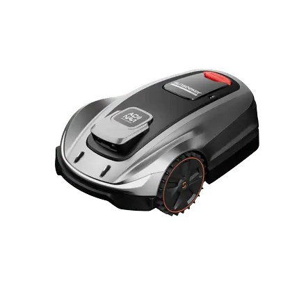
For a practical autonomous outdoor use case, explore Sunseeker’s robot lawn mower range, where positioning is combined with local perception and route planning.
For a current Sunseeker example, Sunseeker Elite X9 uses AONavi™ 2.0, combining network RTK (nRTK) with VSLAM 2.0 for precise positioning and navigation.
Conclusion
RTK, GLONASS, and GNSS describe different layers of satellite positioning: a precision correction technique, a specific constellation, and the broader navigation framework. Centimeter-level RTK performance depends on carrier-phase processing, resolved ambiguities, satellite geometry, multipath control, fresh corrections, and a suitable baseline. Multi-GNSS reception improves signal availability but does not remove local interference. For autonomous outdoor machines, combining precise global positioning with local sensing can provide a more resilient operating workflow, as seen in Sunseeker navigation platforms.
FAQs
What is RTK GNSS and how does it work?
RTK GNSS combines satellite observations with real-time corrections from a reference station or correction network. The rover uses carrier-phase measurements and resolves integer ambiguities to reach centimeter-level accuracy under good conditions. Reliable satellite visibility, low multipath, fresh corrections, and a fixed solution are all important for maintaining that precision.
What is a Global Navigation Satellite System?
A Global Navigation Satellite System, or GNSS, is a satellite-based positioning framework that lets compatible receivers determine position and time from signals broadcast by navigation satellites. GPS, GLONASS, Galileo, and BeiDou are major constellations. Modern receivers often combine several constellations to improve satellite availability and positioning geometry.
What's the difference between GNSS, GPS, and GLONASS?
GNSS is the umbrella term for satellite navigation systems. GPS is the U.S. constellation, and GLONASS is the Russian constellation. A multi-GNSS receiver can use signals from both, plus other supported constellations. RTK is separate: it is a precision correction technique applied to GNSS observations rather than another constellation.

























 X7 / X7 Plus Gen 2High-performance mowing for lawns up to 1.5 Acres.USD 2499 / USD 2999