A flower bed moves, a play area changes, or a new path cuts across the lawn. With a buried perimeter wire, even a small yard update can mean lifting and rerouting cable. A robot lawn mower virtual boundary stores those limits digitally, so the mowing area can be adjusted in software instead.
That flexibility is useful, but the mapping method still matters around trees, buildings, narrow passages, and changing light. This guide compares the main technologies, shows what to check before buying, and explains how to create a map that remains dependable during routine mowing.
How a Virtual Boundary Robot Mower Defines the Lawn
A virtual boundary is a stored map line that tells the mower where its working area ends. The mower must repeatedly match its live position to that map closely enough to stay inside the intended lawn.
During setup, the boundary may be created by driving the mower around the edge, walking with a phone or controller, or allowing supported models to map the area automatically. The resulting coordinates or local map features are saved as a digital mowing zone. No-go areas can then exclude ponds, planting beds, play equipment, or other places that should not be cut.
Daily mowing uses two related functions: positioning and perception. Positioning estimates where the machine is on the saved map. Perception helps it recognize nearby edges, obstacles, terrain, or visual features. A mower may use one source for most of its location data and another to check or refine movement when the primary source becomes less reliable.
This is why “wire-free” does not mean “sensor-free.” A useful system still needs a dependable reference for the lawn, clear rules for excluded zones, and a way to recover its place after a temporary interruption.
Which Virtual Boundary Technology Fits Your Yard?
No single positioning method behaves the same in every garden. The practical choice is the one whose sensing strengths match your sky view, edge detail, obstacles, and layout complexity.
RTK or Network RTK for Open-Sky Positioning
RTK-GNSS uses satellite signals plus correction data to reduce the position error that ordinary GPS can leave behind. In favorable open-sky conditions, many robotic mower systems target centimeter-level positioning, which is useful for repeatable virtual borders and planned mowing lanes. A local RTK setup receives corrections from a nearby base station, while Network RTK can receive corrections through a service over the internet. Large open lawns are the easiest environment because the receiver has a broad view of the sky.
LiDAR for Geometry-Based Mapping
LiDAR measures distance to surrounding surfaces and builds a local geometric picture of the yard. It can work without satellite visibility for its immediate map, so buildings or tree cover do not affect it in the same way as GNSS. It is especially useful where walls, hedges, paths, and other solid features provide stable geometry. Very open areas with few distinctive structures can give a LiDAR-only system less local detail to reference.
Vision-Based Mapping for Feature-Rich Yards
Camera-based mapping tracks visual features such as edges, textures, structures, and objects as the mower moves. In a yard with fences, paths, trees, beds, and other recognizable detail, vision can provide rich local context. Performance can change with strong glare, deep shadow, darkness, lens contamination, or scenes that look highly repetitive, so image quality and the mower’s processing system matter as much as the camera count.
Hybrid Sensor Fusion for Mixed Conditions
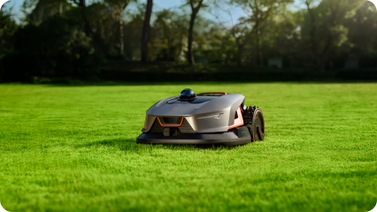
Mixed yards often benefit from a system that can compare more than one positioning source. Sunseeker Elite X9 combines Sunseeker’s AONavi positioning and navigation with a 360° OmniSight scene system. Sunseeker describes the X9 Series as maintaining centimeter-level positioning across open areas, hedge edges, narrow passages, and under trees. For a property that shifts between clear sky and visually complex spaces, that layered approach can keep the saved boundary useful across more of the route without turning routine mowing into repeated remapping.
What to Check Before Choosing a Virtual-Boundary Mower
The navigation label alone does not tell you how easy the mower will be to live with. Check the mapping controls, recovery behavior, and connection requirements before committing to a system.
Boundary Editing and No-Go Zones
Look for app tools that let you move a border, split a lawn into zones, change mowing areas, and create temporary or permanent no-go spaces. Fine editing is valuable around flower beds, pond edges, trampoline legs, and newly planted areas. A system that requires a full remap for every small change can turn a digital boundary into a maintenance chore.
Trees, Buildings, and Signal Obstruction
Map the places where the sky is partly blocked or where tall surfaces sit close to the mowing edge. Dense tree canopies, walls, sheds, and narrow side yards can weaken or reflect satellite signals. For RTK-based models, check how the mower handles degraded GNSS and if another sensor can maintain local navigation. For vision or LiDAR systems, note the quality and stability of nearby features.
Multi-Zone Maps and Transfer Pathways
Separate front, side, and rear lawns need more than multiple saved polygons. The mower also needs a safe way to move between them. Check the minimum supported passage width, route rules for paved connectors, and options for defining non-mowing transfer paths. Test gates, stepping-stone gaps, and narrow corridors before assuming the mower can travel between zones on its own.
Internet or Correction-Service Requirements
Some Network RTK and cloud-connected mapping features need reliable internet or cellular service for correction data, app access, or remote map changes. Confirm what happens during a temporary outage: can the mower continue with cached data, pause safely, or return to the dock? Also check if correction-service access is included or tied to a subscription after an initial period.
Relocalization After Positioning Loss
A useful mower should know how to recover after a short loss of satellite, visual, or local map confidence. Good relocalization means comparing current sensor data with the saved map, restoring a trusted position, and resuming only after that match is strong enough. This is more important than claiming that signal loss can never occur, because real yards include shade, corners, moving objects, and changing conditions.
How to Set Up Virtual Boundaries for Reliable Daily Mowing
A strong map is created by testing the difficult parts of the property before regular schedules begin. Spend setup time on edge cases, then verify that the mower repeats them consistently.
Map the Hardest Edges First
Start with the boundary sections closest to ponds, retaining walls, steep drops, dense planting, or public paths. Follow the manufacturer’s recommended clearance rather than placing the digital line at the absolute physical edge. On RTK systems, avoid saving a critical boundary while positioning quality is visibly unstable. On vision or LiDAR systems, keep lenses and sensors clean and give the mower a clear view of the features it will use later.
Test Narrow Passages and Transitions
Run several supervised trips through gates, side-yard corridors, bridge areas, and zone connectors before enabling unattended mowing. Watch both directions, because the route into a passage may be easier than the return path. If the mower clips an edge or hesitates repeatedly, widen the virtual corridor, adjust the transfer line, or change the route rather than relying on one successful pass.
Recheck Boundaries After Seasonal Yard Changes
Leaves, hedge growth, moved furniture, new planters, snow storage, and construction can change the features around a saved map. Review key borders after major seasonal changes and after any landscaping work near a critical edge. A quick supervised run around the difficult sections is usually more useful than remapping the entire lawn. Update only the zones or exclusions that no longer match the physical yard.
Conclusion
Virtual boundaries can simplify lawn setup because the mowing area lives in a digital map instead of a buried loop of wire. RTK suits open sky, LiDAR and vision add local environmental detail, and hybrid systems can combine those strengths in mixed yards. Reliable results still require careful edge mapping, tested transfer paths, and occasional checks after the property changes. For a broader look at wire-free options, explore Sunseeker’s robot lawn mower range and compare the navigation approach with the conditions in your own yard.
FAQ
Does the robot mower need a boundary wire?
Not if the mower is designed for virtual boundaries. Wire-free models can use RTK, Network RTK, LiDAR, vision, or a combination of sensors to store the mowing area digitally. Traditional robotic mowers may still require a buried perimeter wire, so check the mapping method in the product specifications before purchase.
Do I need a base station or antenna?
It varies by system. Local RTK commonly uses a reference antenna or base station installed where it has a good sky view. Network RTK can receive correction data through a service connection instead. LiDAR- or vision-led systems may not need a GNSS base at all. Check the exact installation and connectivity requirements for the model.
How accurate are the different technologies?
RTK systems commonly target centimeter-level positioning when satellite visibility and correction data are strong. LiDAR and vision accuracy is usually described through map stability rather than one universal distance figure, because results change with features, lighting, range, and processing. Hybrid systems can use one source to support another when conditions become less favorable.



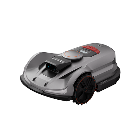
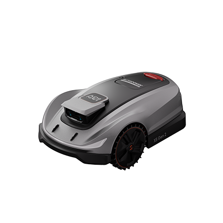

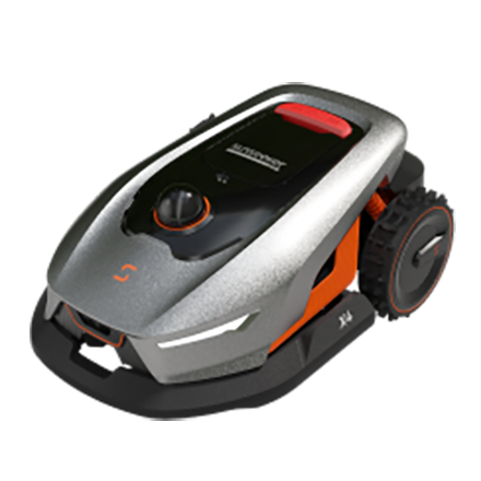
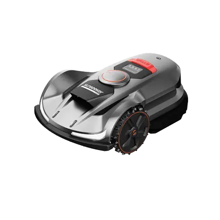

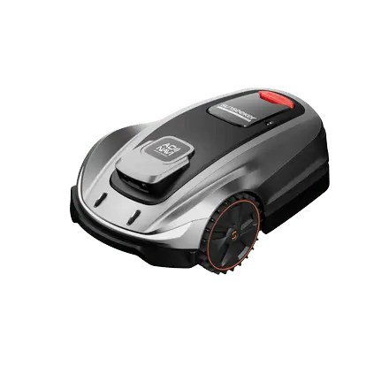


 X7 / X7 Plus Gen 2High-performance mowing for lawns up to 1.5 Acres.USD 2499 / USD 2999