


FAQs
7/16/2026
Contents


VSLAM (visual simultaneous localization and mapping) uses camera images to estimate a robot’s pose and build a map simultaneously. It works best in environments with stable visual detail, adequate processing power, and drift correction via loop closure. Key variables include camera quality, lighting conditions, and supporting sensors like IMUs or wheel odometry. For consumer robots with compact hardware and rich visual context, vSLAM is a strong choice; for low-light or geometry-dependent tasks, LiDAR SLAM or hybrid systems are more reliable.
A robot does not understand your garden the way you do. When it moves through narrow passages, shaded corners, or around obstacles, it is constantly building a map while trying to stay oriented in real time. That is where vSLAM comes in.
Instead of relying on fixed signals alone, visual SLAM uses camera input to interpret surroundings, track movement, and update its position as the environment changes. In this article, you will learn how vSLAM works, why it matters for robotic navigation, and what to consider when evaluating it for real-world use.
VSLAM is camera-based navigation; for most robots, choose it when the environment has stable visual detail and the system has enough processing power and drift correction.
VSLAM stands for visual simultaneous localization and mapping. A robot or device uses camera images to estimate where it is while building or updating a map of its surroundings. The word “simultaneous” matters: localization and mapping happen together, not as separate jobs.
The practical value is straightforward. A robot vacuum, mower, drone, or AR headset can move without relying only on GPS, boundary wires, magnetic strips, or fixed beacons. It watches visual features such as corners, edges, textures, furniture lines, paving joints, walls, and plant-bed borders, then compares new images with earlier ones to work out motion and position.
VSLAM is not magic vision. It works best where the camera can see stable, recognizable detail. Blank white walls, darkness, glare, rain on a lens, fast motion, and repeated patterns make the job harder. Strong systems compensate with better cameras, lighting tolerance, inertial sensors, wheel odometry, and software that detects when the position estimate has started to drift.
VSLAM (Visual Simultaneous Localization and Mapping) helps a robot understand where it is while building a map of its surroundings using only a camera. It works by continuously turning video frames into location and map information at the same time.
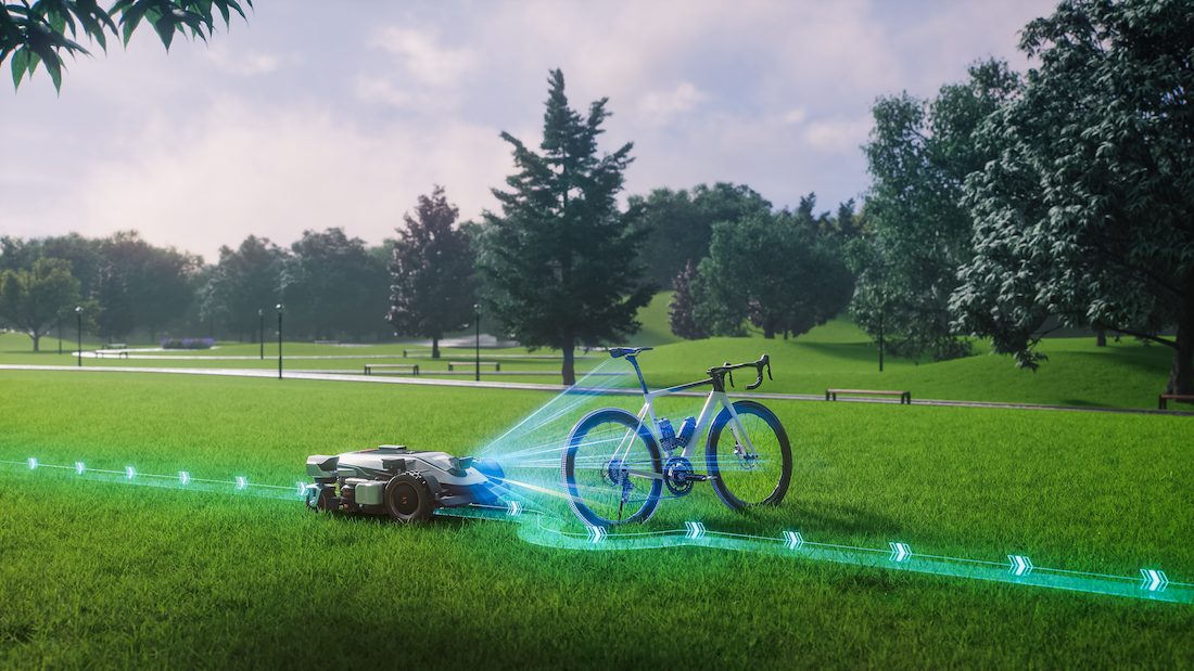
First, the system tracks visual details in the environment, such as edges, patterns, or object points, as the robot moves. By comparing how these points shift between frames, it estimates motion step by step. This process, called visual odometry, gives a constantly updated sense of position and direction.
At the same time, VSLAM builds a map based on the same visual features. This map does not need to look like a floor plan; it simply stores recognizable points so the robot can understand boundaries, obstacles, and where it has already cleaned or traveled.
Over time, small tracking errors can build up. To fix this, the system uses “loop closure,” which recognizes places it has seen before and adjusts the map to reduce drift. This keeps navigation stable and accurate during long operation cycles.
A good VSLAM system is a stack, not a single camera trick. The camera provides observations, the software extracts meaning, and supporting sensors keep the estimate stable when images alone are not enough.
Most VSLAM setups use monocular, stereo, fisheye, or depth-aware camera arrangements. A monocular camera can estimate motion from one viewpoint, but scale is harder unless the system adds assumptions or other sensors. Stereo cameras compare two viewpoints, which helps estimate depth more directly. Wide-angle lenses see more of the environment, which can improve feature tracking in tight spaces.
For outdoor robots, exposure handling is critical. A lawn robot may move from bright sun to shade under a tree in seconds. A weak vision system can lose features during that transition. Dirty lenses, water spots, low sun glare, and night operation also change the quality of the visual input.
The software chooses visual features, matches them across frames, estimates camera motion, builds the map, detects loop closure, and corrects errors. Traditional computer vision still does much of the hard work, especially feature matching and geometric estimation. AI can help with scene understanding, object recognition, semantic labeling, and deciding which parts of the image are reliable.
The strongest systems reject bad visual information. Moving people, waving grass, pets, reflections, and passing cars should not be treated as fixed landmarks. If the map is built from unstable features, navigation becomes inconsistent.
Inertial measurement units, wheel encoders, GPS, ultrasonic sensors, radar, and time-of-flight sensors can all support VSLAM. They do not replace the visual map; they fill gaps when camera data is weak.
For a robot mower, wheel odometry can help estimate short movements, while vision helps identify repeated locations and boundaries. For a drone, an inertial sensor helps during quick rotations. The best designs combine sensors according to the environment’s failure cases, not a buzzword checklist.
VSLAM and LiDAR SLAM solve the same broad problem: locating a machine while mapping its surroundings. The difference is the main sensing method. VSLAM reads camera images. LiDAR SLAM measures distance by sending out laser pulses and timing their return.
Factor | VSLAM | LiDAR SLAM |
Main sensor | Camera | Laser distance sensor |
Strength | Rich visual detail and lower hardware burden | Direct geometry and strong distance measurement |
Weak point | Lighting, glare, texture, and moving visual features | Hardware cost, reflective surfaces, and sparse semantic detail |
Common fit | Consumer robots, AR, compact autonomous devices | Industrial robots, mapping vehicles, high-precision navigation |
VSLAM is most useful where a device needs local awareness without depending on a fixed track. The best examples are machines that must revisit spaces, avoid obstacles, and adapt when surroundings change.
Robot vacuums use VSLAM to build room maps, recognize rooms, improve coverage patterns, and return to the charging dock with fewer random movements. The system helps the vacuum understand that a hallway, sofa edge, and kitchen island are repeatable landmarks rather than isolated obstacles.
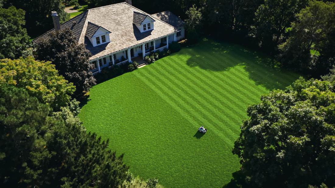
Lawn-care robots face a more complex version of the same challenge. Grass changes appearance with light, weather, and growth, while shadows, slopes, and garden edges constantly shift the visual scene. Systems used in advanced machines like the Sunseeker Elite X9 Series are designed for these demanding outdoor conditions, combining vision-based navigation with strong terrain handling to maintain stable operation across large and uneven areas. The X9 is built for large-scale environments such as estates and sports fields, where it must maintain consistent coverage, handle steep slopes, and continue working even as lighting and surface conditions change throughout the day.
AR devices use VSLAM to keep digital objects anchored to the physical world. If you place a virtual chair in a room, the device must remember where the floor and walls are as you move. Without stable tracking, the object floats, slides, or jumps.
Phones and headsets also use visual tracking for measuring spaces, scanning rooms, indoor positioning, and mixed-reality overlays. The tolerance for error is low because the user sees drift immediately.
Drones use VSLAM where GPS is weak or unavailable, such as indoors, under bridges, near buildings, or in inspection work. Visual navigation helps them hold position, avoid obstacles, and return through a known route.
Warehouses use SLAM-based navigation for mobile robots moving between racks, pallets, and workstations. Autonomous machines in agriculture, construction, security, and delivery use the same principle: combine live sensor data with a map so the machine can make position-aware decisions instead of simply reacting to the nearest obstacle.
VSLAM is the right fit when a machine can rely on stable visual detail and has enough processing and sensor support to control drift. It is especially useful for home robots, AR devices, drone systems, and robot lawn mower applications where flexible, wire-free navigation is needed. If you are comparing systems, check the working conditions first: lighting changes, repeated textures, lens contamination, and how often the device must return to the same spot accurately.
vSLAM is not strictly better than LiDAR; they serve different purposes. vSLAM uses cameras to understand visual features, making it cost-efficient and rich in detail but sensitive to lighting. LiDAR measures distance directly and works more reliably in low light. Many modern robots combine both for stronger navigation accuracy and stability in complex environments.
vSLAM accuracy depends on camera quality, lighting, processing power, and environment texture. In well-lit, feature-rich spaces, it can achieve very stable positioning suitable for indoor mapping and structured outdoor areas. However, in low light or repetitive surfaces, small drift errors can occur over time, which systems reduce through loop closure and map correction.
Yes, modern vSLAM systems often use AI to improve feature detection, object recognition, and navigation decisions. AI helps the system identify meaningful visual points, filter noise, and adapt to changing environments like moving objects or lighting shifts. This improves map stability and allows more reliable real-world performance in dynamic conditions.